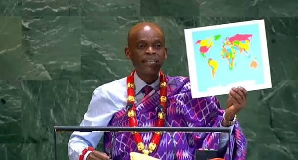
The United Nations has overwhelmingly backed a proposal encouraging the use of world maps that more accurately represent the true size of Africa and other continents, reigniting a global debate over how traditional maps have shaped perceptions of the world.
The resolution, dubbed the “Correct the Map” initiative, received overwhelming support, with the United States reportedly emerging as the only country to vote against the proposal.
At the centre of the debate is the widely used Mercator projection, a centuries-old map design that distorts the size of land masses, particularly those closer to the North and South Poles.
Under the Mercator projection, countries and regions in northern latitudes, including Greenland, Europe and North America, appear significantly larger than their actual land areas, while Africa and other regions near the Equator appear comparatively smaller.
Supporters of the UN-backed initiative are advocating for alternatives such as the Equal Earth projection, which provides a more proportionate representation of the relative sizes of continents and countries.
The difference is particularly striking in Africa's case. Although Greenland can appear almost comparable to Africa on some traditional world maps, Africa is in reality about 14 times larger.
Campaigners argue that the continued use of distorted maps has contributed to misconceptions about Africa's geographical size and global significance, particularly among generations of students who have grown up using the Mercator projection.
The initiative does not seek to redraw international borders or physically alter the geography of the world. Instead, it calls for greater consideration of map projections that give viewers a more accurate understanding of the relative size of land masses.
The United States' reported opposition to the proposal has added another layer of controversy to the debate, with supporters questioning why Washington would oppose a resolution centred on more proportionate geographical representation.
The UN vote is being seen by supporters as a symbolic victory for Africa and the Global South, although the adoption of alternative map projections will ultimately depend on governments, schools, publishers, technology companies and other institutions responsible for producing maps.
As the debate spreads, one question is increasingly dominating social media and public discussion: Has the world been seeing Africa through a distorted lens for centuries?